Erasure at Kentland Farms
In regards to studying the history of the Kentland Plantations, a majority of the public tends to focus on the land itself, whether in regards to architecture, artifacts, or a survey into land ownership. This focus, while necessary, lacks a deeper look into exploring the lives of the individuals who had an impact on the land.
But what is the importance of studying the lesser-known history of Kentland? Calling attention to these obscured histories that emerged from the plantation allows the public to view history in a comprehensive way, one that aids the remembrance and honoring of all the people who have a connection to the land.
Table of Contents
- Indigenous History
- 18th Century Settlement
- Transportation Route
- 19th Century House & Slavery (Antebellum)
- Sharecropping
- Education & Christiansburg Institute
- Modern Wake Forest
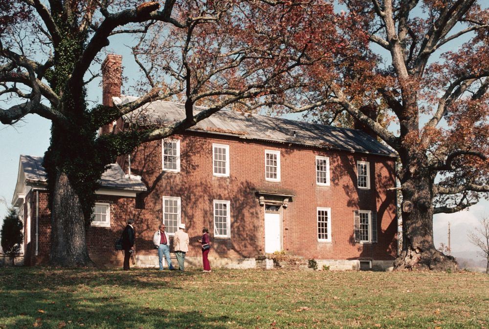
Indigenous History
In 2018, the Monacan Nation was officially recognized by the federal government. Today, the Monacan Indian seal represents tenacity and survival. The bear connects the Monacan Indian Nation and symbolizes the tribe’s continuous endeavors toward justice and acknowledgment.
Eastern Siouan-speaking people inhabited the New River Valley before English colonization. After 1000 C.E., the Monacan Alliance exerted political influence in the Piedmont and Mountain regions. There was one tribe in particular that inhabited the James River’s falls, the Monacans. Because the Monacans were the foes of the Powhatan Chiefdom, a Nation in eastern Virginia, early European immigrants made little contact with them. According to the Virginia Tech Agricultural Experiment Station, archeological research (1991) discovered a hamlet on the farm grounds that may have been from the Late Woodland Period (C.E. 800-1600).
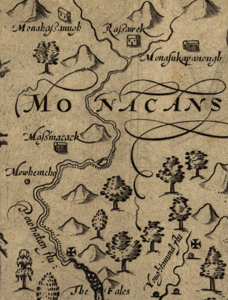
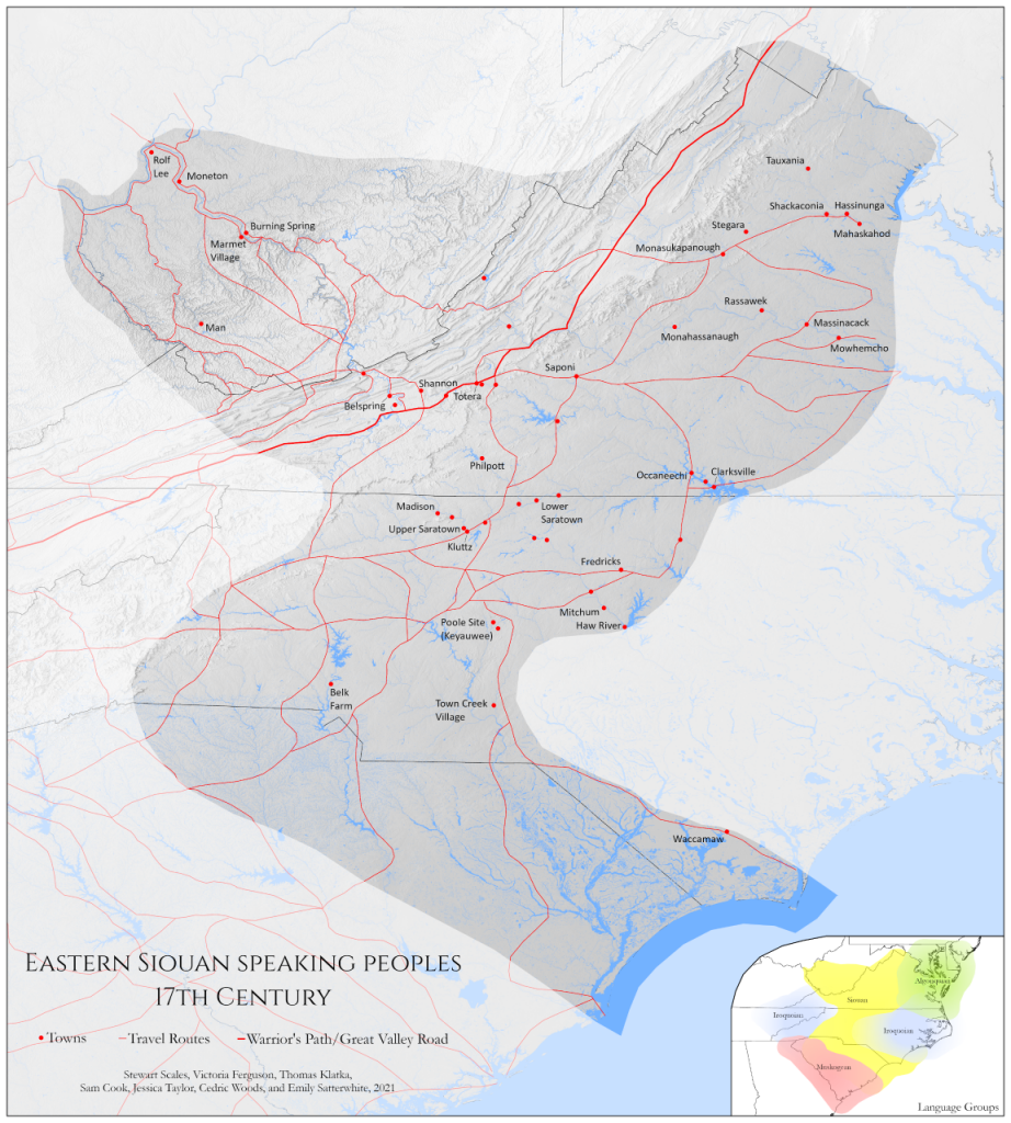
Before colonization, Eastern Siouans buried their dead in mounds of soil, excavating and reburying them during recurring rituals. Thirteen known mounds date back up to 1000 years (Encyclopedia Virginia).
Kentland Farms contains several places inhabited as early as 800 A.D. On the riverbank, there formerly was an Indian settlement (Kentland at Whitehorne 1). Farmers and archaeologists have found Native artifacts such as projectile points and pottery. There was a Native town from the end of Toms Creek down to the New River, and a burial ground near the bridge that crosses the creek. When the Virginia railroad was constructed in the 1880s, the graveyard and other artifacts were all destroyed (KW 2). Currently, the Native town and burial grounds are crossed by Norfolk and Southern railroad lines, in essence burying any remnants of Indigenous past.
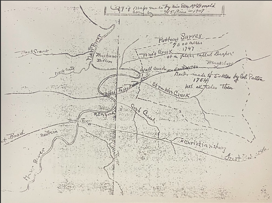
In the eighteenth century, settlers began seizing and reshaping Indigenous land. In the Treaty of Middle Plantation signed in 1680, the English promised to maintain three miles clear of Native communities; the Virginians broke that pledge. James Patton, the county lieutenant of current Augusta County, made the decision to build a road to New River in 1745. In April of 1745, Patton and his surveyor, John Buchanan, plotted the route that would become modern-day Route 11. During this period, Augusta County was considerably bigger and comprised modern-day Montgomery County. Following the “Old Indian Road,” which Native Americans used as a trade route, Buchanan followed Catawba Creek, passed the Allegheny Divide, and entered the New River basin. This route crosses near Kentland, via Prices Fork, and into Blacksburg.
18th Century Settlement
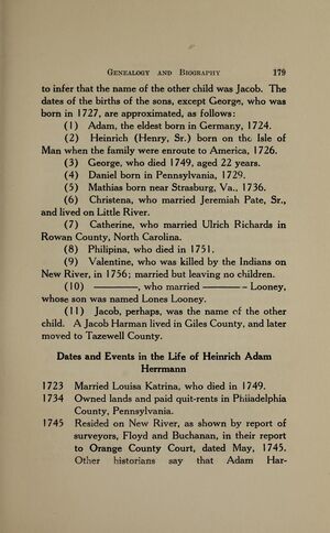
The first white settler to be recorded as inhabiting Whitehorne was Heinrich Adam Harman. The Harmans were the first family to reside on the plantation that is now known as Kentland (Kentland at Whitethorne, 10). They were Czech, or West Slavic, by birth, and of Moravian origin. Heinrich Harman married Louisa Catrina in 1723 and between them they had eleven children and relocated to the Isle of Mann (Kentland at Whitethorne, 10). Adam Harman constructed his residence at what is now Kentland. His family relocated multiple times until they eventually settled in the Shenandoah Valley. Here, Adam produced gunpowder so he could hunt game and kill Indigenous people who sided with the French during the French and Indian War. This is where the modern day Radford Army Ammunition Plant stands today. He fought and massacred the Shawnee during the French and Indian War where his brother Jacob was killed during a Shawnee raid in 1756. Adam Harman later died in 1763 and the land was repossessed which later was taken by William Preston and John Buchanan (Kentland at Whitethorne, 10).
Germans from the Rhineland arrived at Toms Creek, near Adam Harman’s home, by 1747. The Price, Harlesses, Longs, and Walls were the prominent German families. Toms Creek and the “Big Horseshoe ” land were sold by Lisreal Lorton, James Patton’s agent. The Lutheran Germans who recently arrived, originated from the Rhineland Pfalz communities of Offenbach and Landau in Heidelberg. (KW 12). They were from the Palatine on the Rhine. Significant in the Blacksburg region, Michael Price built a mill and cabin by Toms Creek, while Augustine Price constructed his cabin on the eastern bank of the New River where the road that descends from Prices Fork to the river’s bottom meets the road.
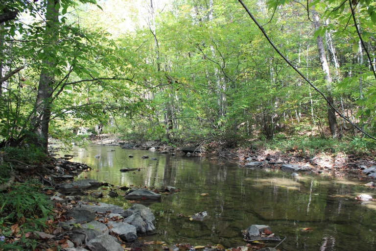
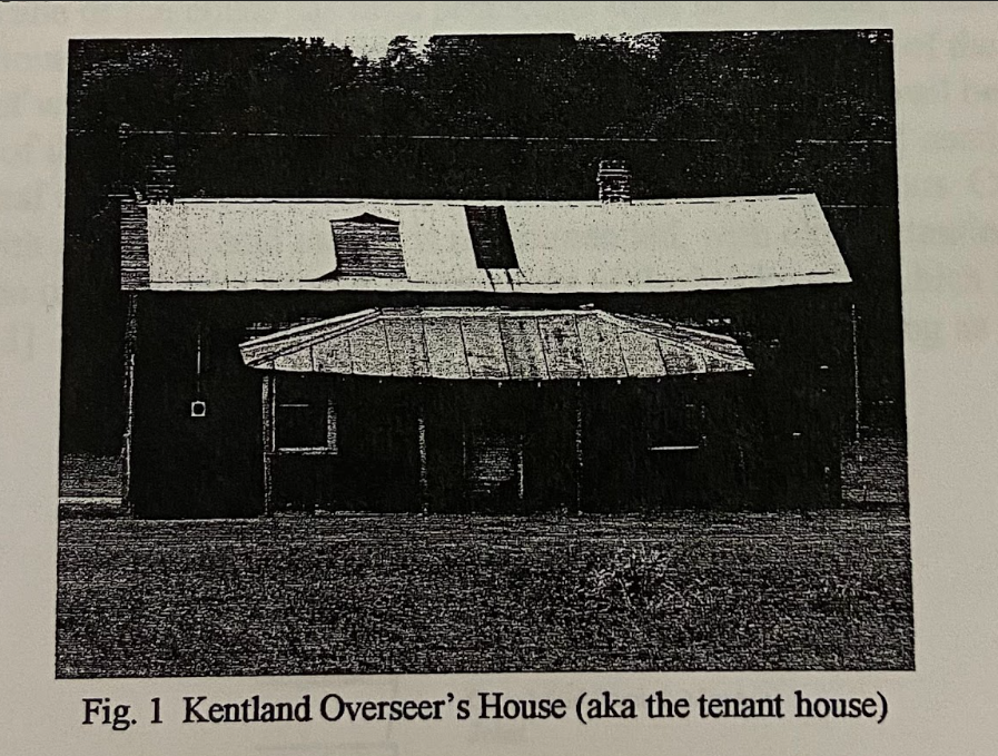
Louisa Catrina Harman later passed away in the small cabin on the property of present day Kentland and very well was the first white woman to have died and been buried on the property. This building later became the Overseer’s House and located just around a few hundred feet from the manor house. This particular Tenant House had very obviously been dated to the 18th century and predates the manor house by at least 50 years. This is shown from nails that were recovered from the original building that are hand forged which aided the dating of the house to the later part of the 18th century. Unfortunately, this house is no longer on the Kentland property.
Transportation Routes
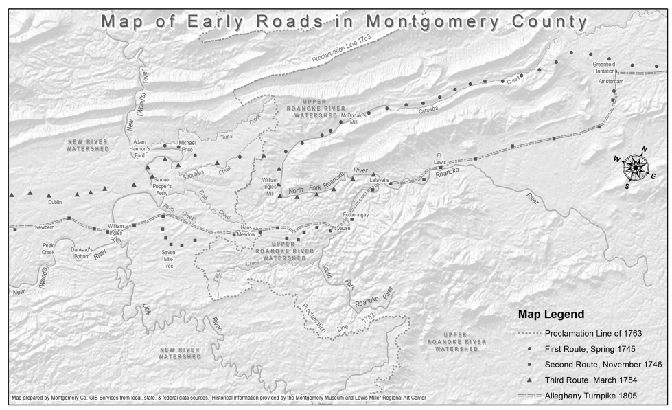
Beyond original paths that could’ve been used by early settlers, the first significant road in the Montgomery County area was surveyed by Colonel of the Augusta County Militia, James Patton, and Deputy Surveyor, John Buchannan, running from the Frederick County line in Northern Virginia to Harmon’s Ford on New River in Montgomery County, as stated in a 1745 Orange County Book Order entry. John Harmon, captain of the Augusta County local militia, oversaw the construction of the road in 1746. The initial Orange County Book Order served as the first-ever reference to Kentland Property (Jones and William 2005, 8–9)
19th Century House & Slavery (Antebellum)
The Kentland Plantation contained many structures throughout its life such as the manor house, enslaved people’s quarters, smokehouse, and two cemeteries. While some of these structures remain well known and still standing, others do not. The legacy of these structures has become a part of the hidden history of Kentland.

Kentland Farm was previously named Buchanan’s Bottom, but the name was changed in honor of James Randall Kent, who inherited the land alongside his wife. Oral histories state that John Swope, a former Hessian soldier, built the manor house. The construction of the manor house at Kentland Plantation took place from the 1820s to the early 1830s. Prior to the Civil War, Kentland Plantation was the largest plantation in Montgomery County at almost 6,000 acres. An estimated 120 enslaved people lived under James Kent during the 1850s. ( Seabrook et al., 2023)
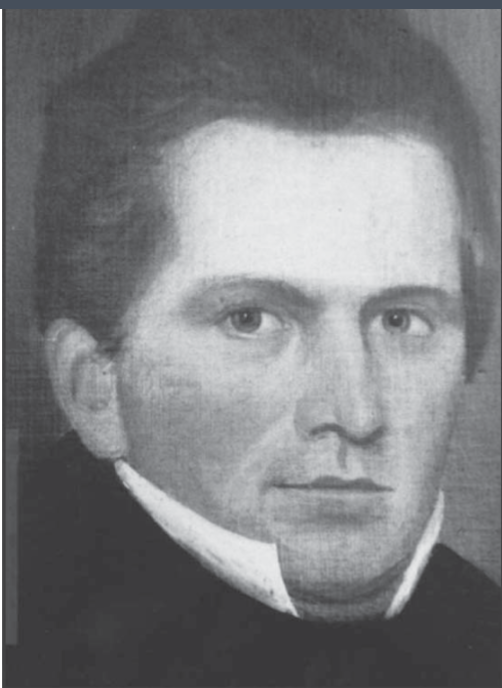
The Civil War changed life for the residents of Kentland. In 1864, Union forces swept through Montgomery County and, according to James Kent, took with them 52 enslaved people from Kentland(Thorp 2018, 398). Campbell Hopkins was one of those men. Hopkins served in the 45th U.S. Colored Infantry, the same infantry that was present at Abraham Lincoln’s second inauguration, until the end of the war. Slavery was abolished with Union victory, and Kentland underwent a transition to freedom that plantations across the south faced (Thorp 2018, 399–401).
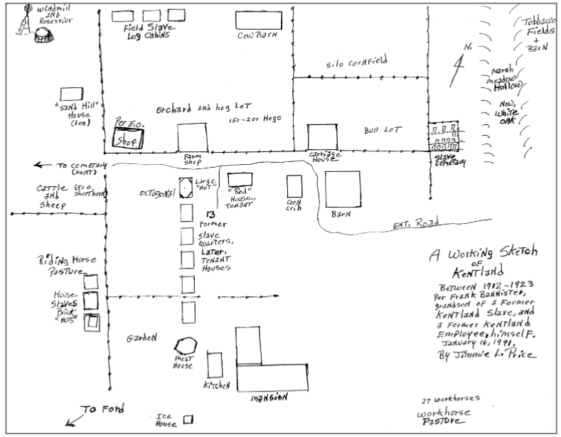
From 2004-2006, faculty and students from Virginia Tech and Radford, led by Thomas Klatka, excavated the plantation’s quarters where some of the enslaved African Americans lived. The excavation utilized a map, created by Jimmy Price, based on Frank Bannister’s documented oral history. Bannister, a former resident of Kentland during the 1910s, detailed where enslaved people’s quarters and cemetery had been on the property. Archaeologists found artifacts that included pottery pieces, animal bones, and hand-forged nails at the site of the slave quarters (Klatka 2006, 1-2). Archaeologists had no knowledge of the sites until the early 21st century despite Wake Forest residents’ knowledge of the cemetery, which had been passed down through former residents’ recollections.
The excavation revealed that the enslaved African Americans at Kentland likely made the bricks used in the construction of the quarters. Similarly, the enslaved people of Kentland likely made many of the other bricks and limestone blocks that built other structures at Kentland, including the limestone blocks that laid the foundation for the Kent family house.
Additionally, a brick-made smokehouse stands on the Kentland property. This structure was found to be significant because of its hexagonal shape and is one of the only remaining structures still standing on the Kentland property (Kern, Pezzoni, and Boyd 1990, section 7, page 3). Scholars believe West African architecture inspired the smokehouse. While archaeological evidence for this theory is inconclusive, Academics familiar with the site believe the theory to hold truth (Cook and Klatka 2015, 33).
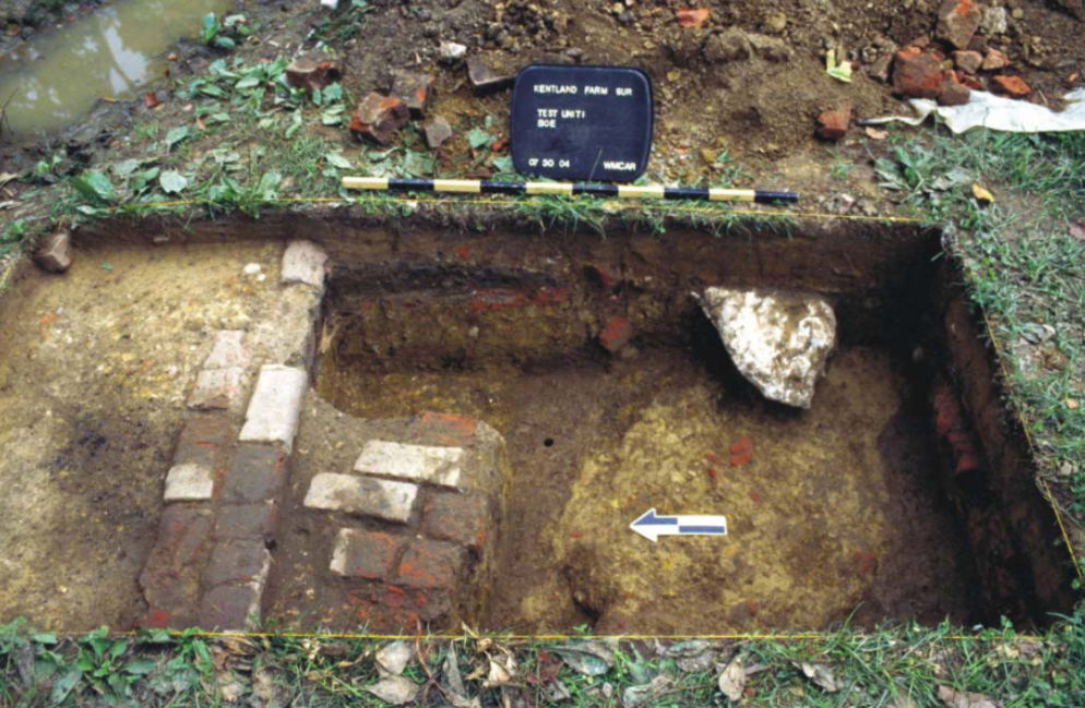
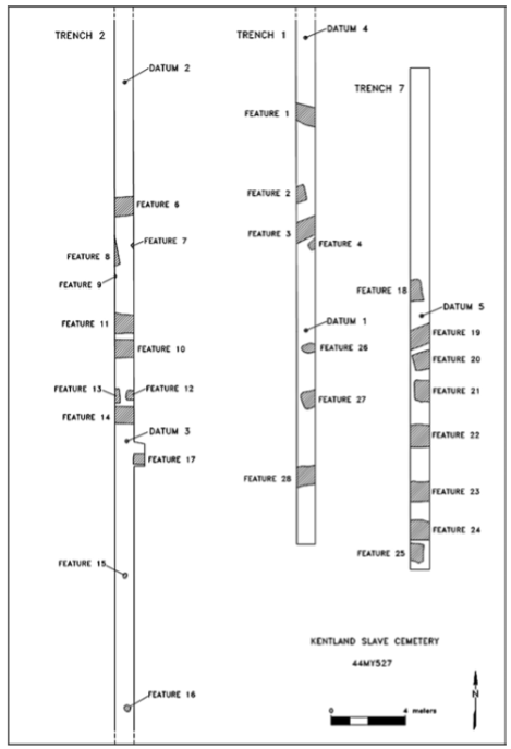
Jimmy Price’s map showed evidence of enslaved people’s cemetery on Kentland Plantation, which was destroyed and forgotten in the early 20th century. Using memories of those who had either worked or lived on the land when the cemetery was still standing, archaeologist Thomas Klatka began to narrow down the cemetery’s location. With approval from both Virginia Tech and the Wake Forest community, excavation on the site began in 2004. In removing only the top layer of soil and not disrupting any remains, Klatka and his colleagues discovered the graves of eighteen adults, three children, and two infants. The direction of the graves suggests they were constructed in accordance with the Christian faith, which still remains an important part of life for the Wake Forest community (Cook and Klatka 2015, 27).
While the manor stands as the most popular structure on the plantation, there are many other historical sites that reveal the history of the land throughout the 19th century. The destruction of some of these sites has contributed to the erasure of the history of Kentland Plantation and can only be combated with written evidence and the preservation of remaining sites.
Sharecropping
The rise and fall of a trade is as old as time itself and is commonplace in any society. Black Appalachia’s shift from sharecropping to coal mining throughout the 20th century depicts this. The public’s view of Black Appalachia remains as the population being historically miners instead of sharecroppers. But what is the importance of sharecropping in Appalachia? And why, with the shift to mining and the rise of modern-day Appalachia’s current industries, was sharecropping disregarded?
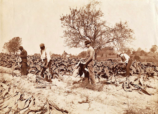
Overnight, the ratification of the 13th Amendment emancipated a class of uneducated Black laborers, skilled in agricultural work and lacking opportunities for land ownership. In response, many white landowners, to prevent economic losses from the abolition of their free labor source, implemented sharecropping (Riddle 1955, 55–56). In this system, a tenant farmer cultivated a certain amount of land belonging to the landowner in exchange for an agreed-upon dividend of the crops harvested. Economically disadvantaged freedmen would often engage in a credit system with the landowner to pay for supplies needed for both farming and life in exchange for a share of the crops produced. The credit system would then, in turn, cut the freedmen’s profit. This contributed to an unsustainable power imbalance between the white landowners and the freedmen, one that would lead Black Appalachians to seek opportunities through other means, and a disconnect between associating sharecropping and Black Appalachia occurred.
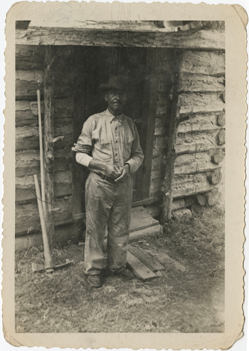
With African Americans gaining increased opportunities to buy land, more and more moved from sharecropping to other industries. No legal barriers stopped African Americans from buying property in Montgomery County, but the impoverished freedmen class often could not afford to raise enough money to purchase it (Thorp 2017, 85). As the Reconstruction era of the 19th century passed an increasing amount of African Americans in Montgomery County began becoming landowners, many through a generational communal effort. Many African-American landowners received help buying land from friends and families, including white benefactors. (Thorp 2017, 85–91). With these trends in the Montgomery County region contributing to the development of a Black, landowning class, sharecropping began its descent into irrelevance in the area.
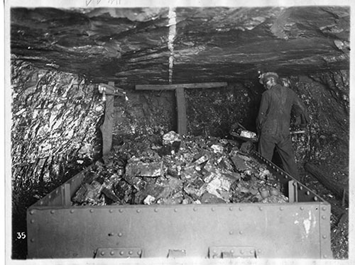
These blatant inequalities associated with sharecropping led to an interest in mining in the Montgomery County area. (Cooke 1992, 95–96). In the early 1900s, the goals of mining companies Big Vein and Great Valley of integration helped establish a guild of Black miners in the area. Both companies stated an incentive “to promote racial harmony” and hired equally paid white and Black miners (Cooke 1992, 97). The companies were able to create an “interdependency” among these workers fostered by integrated work in the mines (Cooke 1992, 97). Black Appalachians began labeling themselves as miners, in contrast to farmers, as a result of access to this occupation(Cooke 1992, 97). While mining is no longer isn’t the most popular job of choice for many Black Appalachians, it still stays relevant in its association with the region because it is popularly viewed as an industry that lacks prejudice towards Black Appalachians, a view unavailable to sharecropping.
In reference to Black Appalachia’s working trends, few people will mention sharecropping as a major industry, yet, its prominence in the 19th and 20th centuries helped lead the way to the dominance of coal mining and aided in setting up the racial climate that followed Appalachian society for years.
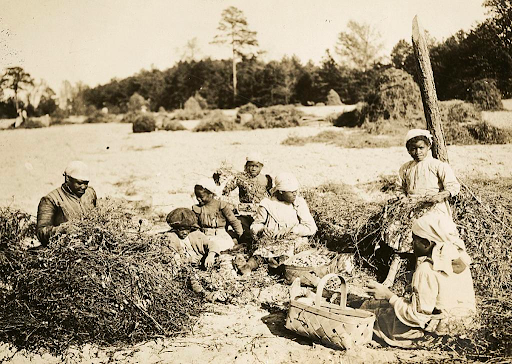
Click the arrow for additional information on sharecropping in Montgomery County!
For some members of Montgomery County, sharecropping symbolized the almost persistent inability for the economic advancement of Black people in the county. Mason Scott, a resident of Montgomery County during the 1900s, states the white sharecropping class “didn’t own much more than the Blacks did, or even as much.” Yet at the same time, Scott mentions that impoverished white sharecroppers “broke out of this syndrome.“ Unlike Black sharecroppers, they were afforded the opportunity to work the better-perceived “factory jobs” that were never an option for Black people in segregated Montgomery County. (Scott 1991, 56:00–58:00) Frank Bannister, another resident of Montgomery County, describes sharecropping as “as much work on the farm as you would get.” Bannister relays a continuing struggle for the creation of a land-owning African American class in Montgomery County (Bannister 1991, 19:00–20:00).
Education & Christiansburg Institute
Christiansburg Institute played a crucial role in uplifting surrounding Black communities, and despite its lack of representation in many regional histories, it remains important to the New River Valley and a national network of Black alumni in the twenty-first century.
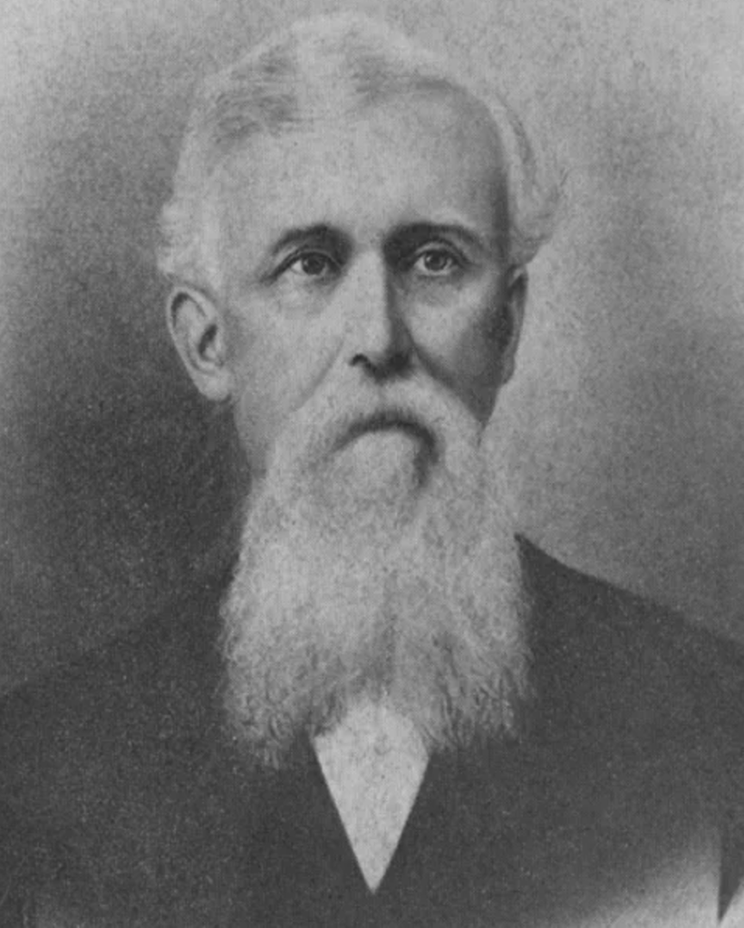
The Christiansburg Institute was a segregated school that catered to the entire southwest Virginia area, particularly the Black communities in the Wake Forest and Kentland areas. Captain Charles S. Schaeffer founded the institute in 1866 to educate the formerly enslaved population in the area. This was one of the few opportunities Black children in Virginia had to receive an education past elementary school, an inequality which resulted in few African-American students in the region garnering the ability to pursue a classical education and skilled work. Educators at the Christiansburg Institute sought to overcome this barrier (Wright & Taylor, 2003). The school offered 8th through 12th grade and an average school day started with religious devotion, then followed by six-hour-long classes, taught by a single teacher. (Johnson & Noland, 2012, 25).
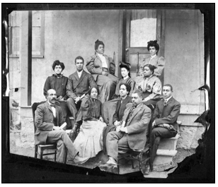
Age varied for the students attending the Christiansburg Institute, and in the years after the Civil War, it was not unusual for adults to attend the school in order to learn how to read, a skill previously illegal for enslaved people in the antebellum South (Thorp, 2013, 4). Originally, the institute’s schedule revolved around the harvest season, with attendance peaking during the winter when there was little agricultural work to do (Thorp, 2013, 24). The school closed during the summer and typically opened in the middle of autumn as farm labor lessened. Funds given by the government and the personal funds of the principal and founder, Charles Schaeffer, contributed to a new building to accommodate the growing school. Quaker and government funds also contributed to the addition of a second teacher (Thorp, 2013, 17). This education ensured that the recently freed residents of the community could create their own future and record their own past. Freedmen would no longer have to experience the constant dismissal of their history again.
Renowned civil rights activist Booker T. Washington became the advisor of the school in 1896 (Thorp, 2017, 225) and used his influence to provide administrative staff and publicity for the school (Cooke, 1992, 98). First-hand accounts of his time as an advisor say Washington toured the greater Christiansburg area and called upon his Tuskegee Institute colleagues to fill vacant roles in the school, such as principal (Cooke, 1992, 98). Washington also gave an address in 1909 to Black and white residents of Christiansburg in support of the institution and his new ways of education (Thorpe, 2017, 225).
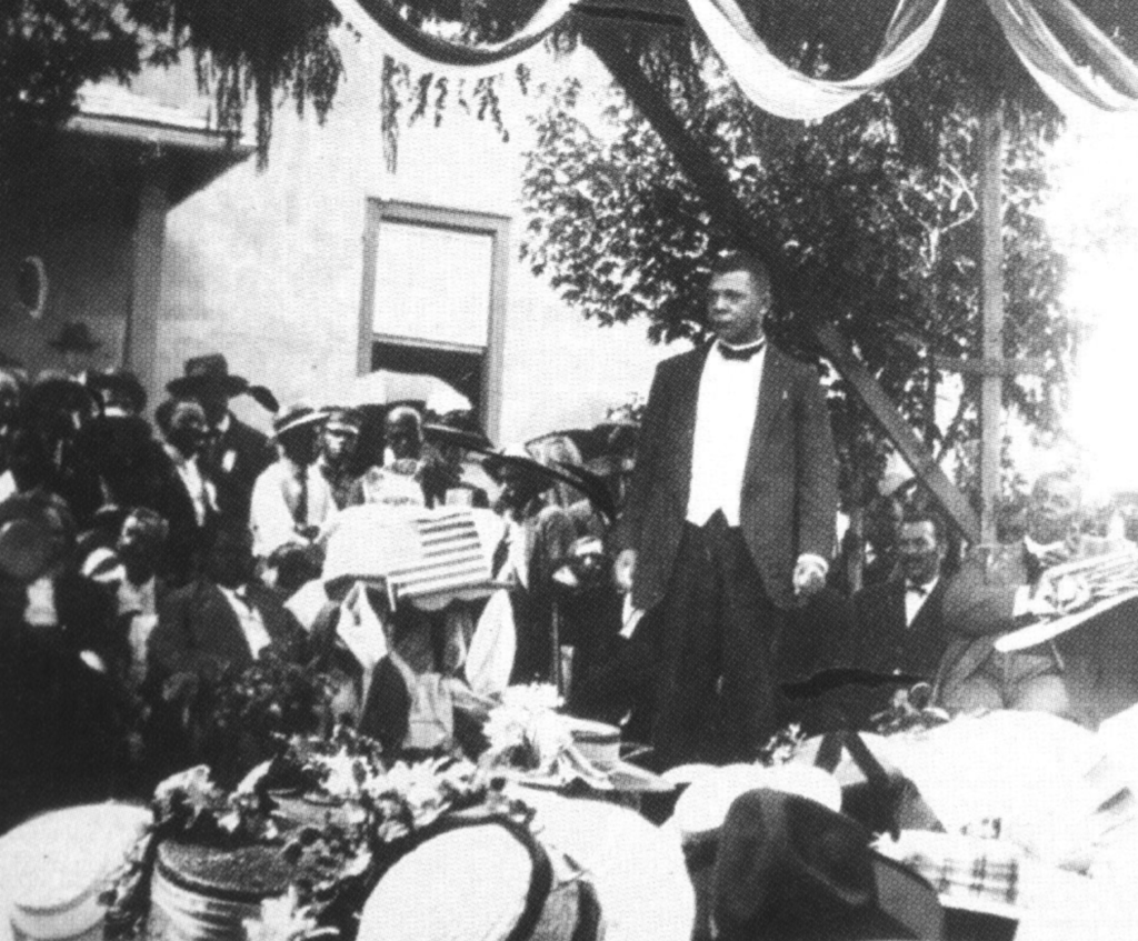
A new agriculture and technical campus was built as the student body grew and the institute’s 185-acre farming campus eventually peaked at 15 buildings. In 1954, Christiansburg institute built Scattergood Hall, the first modern gymnasium in the region (Christiansburg Institute, 2023, 8). Scattergood Hall contained a theater, classrooms, and room for new activities such as football, cheerleading, and band (Davidson & Loumiet, 2012, 12) and ultimately symbolized the Christiansburg Institutes progress in providing quality education and opportunities to African-American in the Southwest Virginia region .
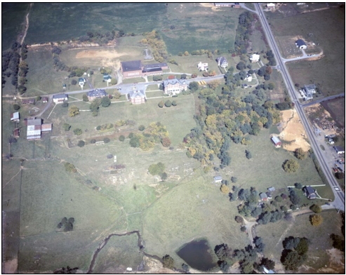
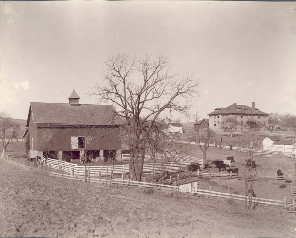
Between 1924 and 1941, the school officially transformed from a private institution, separate from the county’s school system, to a public institute funded by Montgomery County (Christiansburg Institute, 2023, 9). The institute’s enrollment dropped drastically to just under 100 students during the 1950s and 60s as a result of the desegregation of schools. (Johnson & Noland, 2012, 76). The school was forced to close its doors in 1967, and the the Montgomery County Board of control sectioned off the campus and sold it at auction (Christiansburg Institute, 2023, 11).
Today, the staff, alumni, and community organizers of Christiansburg Institute, Inc. are bringing the school back into the public eye. Christiansburg Institute’s ongoing preservation explores new stories from the Institute’s past.
Click the links below to explore oral history accounts!
Modern Wake Forest
While the community of Wake Forest remains relatively obscure in American history , its inhabitants and ancestors have had a prominent presence and impact in the Montgomery County region since the antebellum period. Their history has shaped the region in ways that spread farther than the community’s presence on a map.
The formerly enslaved families on Kentland Plantation founded the community, which were approximately two miles away from the plantation’s official grounds (Thorp, 2023). The systematic erasure of Black communities in and outside of Wake Forest, has led to a lack of information surrounding the purchasing of the land. The documents and oral accounts were not a priority to the white community that controlled the documentation of the area during this time.
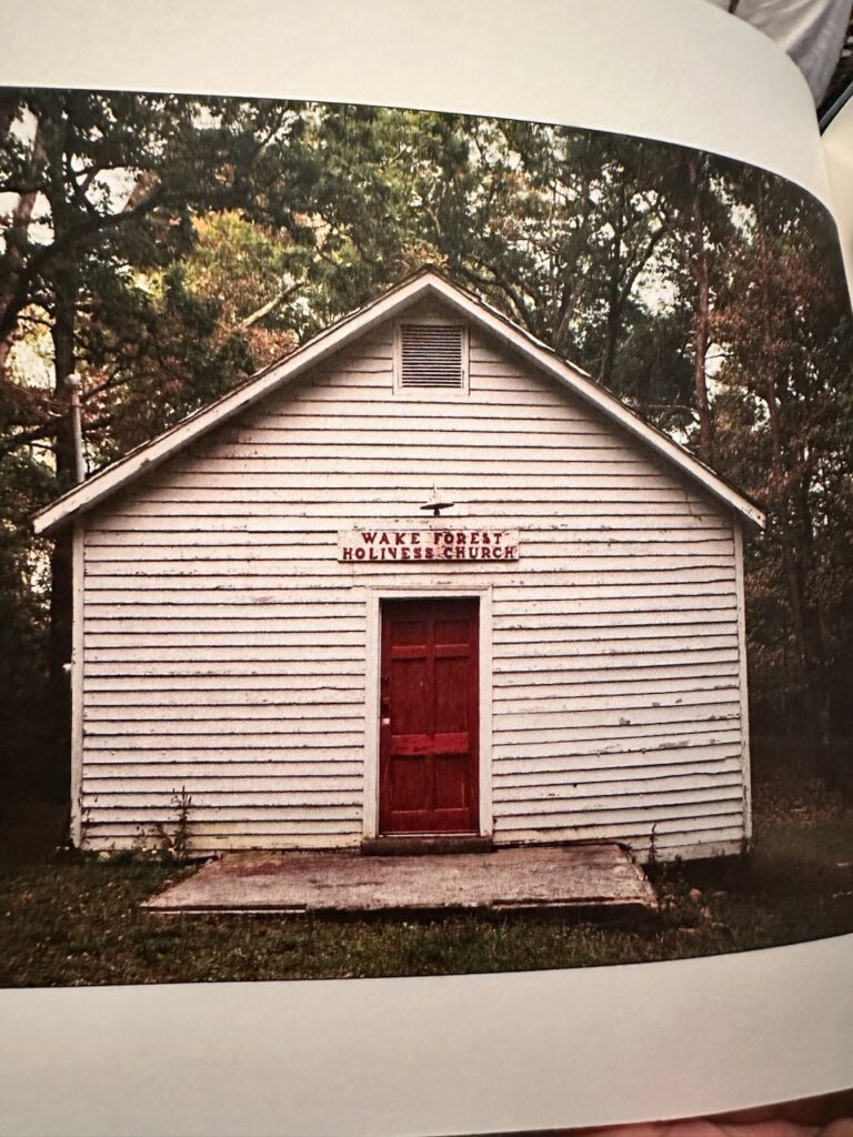
One of the community’s first initiatives was to build the Wake Forest Baptist Church. Community members credited the founder of Christiansburg Institute, Charles Shaffer, with helping Wake Forest build the church(Christiansburg Institute, 2023, 9).
Today, the community of Wake Forest is still active in the preservation of the Kentland Plantation, which remains a priority to those who wish to encase the eras of history in which their ancestors were alive. Without the acknowledgment of the forced labor the enslaved of Kentland gave, the history of Kentland Plantation would be incomplete. To uphold Kentland and its history is to create space and remembrance of it’s predecessors.. In late 2005, the community collaborated with Virginia Tech to build a monument commemorating the enslaved people who died on the plantation. This monument was a huge step within the Kentland community because it stopped the further erasure of the enslaved people of Kentland. The monument physically marked the people who had lost their lives while enslaved at Kentland, and that distinction permanently solidified the deceased enslaved people in history books that previously would have glossed over them.
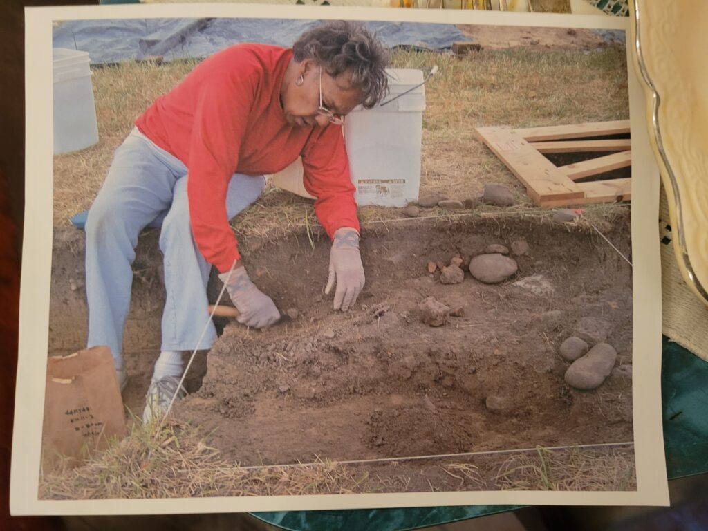
Jean Eaves was a member of the modern Wake Forest community who actively participated in excavation at Kentland. Eaves passed away in 2019.
The Community of Wake Forest demonstrates that, no matter how hidden a people’s history may be, it is never forgotten and lives on through the people themselves.
Citations for Information & Pictures
Christiansburg Institute. 2023. “African American Legacy Tour: Montgomery County.” ArcGIS StoryMaps. October 16, 2023. https://storymaps.arcgis.com/stories/0a9a7211ed664f4d8461c34238254950.
“Christiansburg Institute – Montgomery Museum of Art & History.” Montgomery Museum of Art & History – To connect and engage the community through the arts and the preservation and interpretation of history, November 16, 2018. https://montgomerymuseum.org/learn/historic-christiansburg-walking-tour/christiansburg-institute/.
“Christiansburg Institute.” Virginia Center for Civil War Studies. Accessed December 1, 2023. https://civilwar.vt.edu/christiansburg-institute/.
Cooke, Michael A. ORAL HISTORY WITH FRANK BANNISTER, FEBRUARY 26, 1991 (MS1991-019). Other. Accessed November 1, 2024. https://digitalsc.lib.vt.edu/items/show/13380.
Cooke, Michael A. ORAL HISTORY WITH VALERIE SCOTT, MASON SCOTT, AND JAMES E. DOW, MARCH 16, 1991 (MS1991-019). Other. Accessed November 1, 2023. https://digitalsc.lib.vt.edu/items/show/13569.
Cooke, Michael A. “Race Relations in Montgomery County, Virginia 1870-1990.” Journal of the Appalachian Studies Association 4 (1992): 94–104. http://www.jstor.org/stable/41445626.
Crofts, Daniel W. Review of From Slavery to Sharecropping, by Edward Royce and Julie Saville. Reviews in American History 23, no. 3 (1995): 458–63. http://www.jstor.org/stable/2703319.
Davidson, Naomi. 2012. Oral History with Naomi Davidson Interview by Susannah Loumiet. https://digitalsc.lib.vt.edu/items/show/10618.
Johnson, Charles. 2012. Oral History with Charles Johnson Interview by Ryan Noland. https://digitalsc.lib.vt.edu/items/show/10736.
Jones, Joe B., Moore, William H., Archaeological Survey and Limited Evaluation, Kentland Farm Historic and Archaeological 60District (060-0202), Montgomery County Virginia, Virginia Department of Historic Resources, Richmond, VA, 2005.
Kern, John, Daniel Pezzoni, and Clifford Boyd. Rep. National Register of Historic Places Registration Form. Roanoke, VA, 1990 https://www.dhr.virginia.gov/VLR_to_transfer/PDFNoms/060-0202_Nomination_REDACTED.pdf .
Klatka, Thomas, and Samuel R Cook. “The Nexus of Collaboration: Negotiating African American History and Public Interest in Southwest Virginia.” Anthropology Now. September 2015. https://www.jstor.org/stable/26775124.
Klatka, Thomas. Rep. Descriptive Report on the 2006 Archaeological Excavations at the Kentland Quarters Site (44MY431), Montgomery County, Virginia., n.d.
“New Exhibit Brings to Light the Experience of Black Coal Workers in Appalachia.” Brown University. Accessed December 1, 2023. https://www.brown.edu/news/2016-06-01/black-shackle.
Page, Jim and Sherry Joines Wyatt, “The Nigh and Best Way: Early Development of Roads in Montgomery County,” Smithfield Review 21 (2017), 65-79.
Price, Jimmy, New River Map, Map, Frank Bannister, 1977.
Riddle, Wesley Allen. “The Origins of Black Sharecropping.” The Mississippi Quarterly 49, no. 1 (1995): 53–71. http://www.jstor.org/stable/26475959.
Thorp, Daniel B. “LABOR, LAND, AND MAKING A LIVING.” In Facing Freedom: An African American Community in Virginia from Reconstruction to Jim Crow, 70–117. University of Virginia Press, 2017. https://doi.org/10.2307/j.ctv8d5sxz.8.
Seabrook, Tom, Lucas Kelley, Paul Quigley, Kevin Caprice, and Kevin Dawson. “Kentland Plantation.” Virginia Center for Civil War Studies. Accessed November 1, 2023. https://civilwar.vt.edu/kentland-plantation/.
Sherman, James. 1991. Oral History with James E. Sherman, March 11, 1991 Interview by Micheal Cooke. https://digitalsc.lib.vt.edu/items/show/13571.
“The Monacan Nation and Politics of Memory.” The Land Speaks. Accessed December 1, 2023. https://exhibits.lib.vt.edu/the-land-speaks/.
“The New River.” Virginia Tourism Corporation. Accessed December 1, 2023. https://www.virginia.org/listing/the-new-river/6997/.
Thorp, Daniel B. “History of Montgomery County .” Lecture. November 8, 2023, Virginia Tech, Blacksburg, VA.
Thorp, Daniel B. “Soldiers, Servants, and Very Interested Bystanders: Montgomery County’s African American Community during the Civil War.” The Virginia Magazine of History and Biography 126 (2018). https://www.jstor.org/stable/26538017?seq=1.
Thorp, Daniel B. “The Beginnings of African American Education in Montgomery County.” The Virginia Magazine of History and Biography 121, no. 4 (2013): 314–45. http://www.jstor.org/stable/24392972.
Thorp, Daniel B. Facing Freedom: An African American Community in Virginia from Reconstruction to Jim Crow, 118–60. University of Virginia Press, 2017. https://doi.org/10.2307/j.ctv8d5sxz.9.
Wright, Kenneth . 2003. Kenneth Wright Intervie, Special Collections and University Archives.
